Konstelacja Beidou gotowa 23.06. o 01:43:04,200 z Xichang wystrzelona została RN CZ-3B/G2, która wyniosła na orbitę satelitę nawigacyjnego
Beidou-3 G3. Tym samym zakończono kompletowanie konstelacji.
http://lk.astronautilus.pl/n200616.htm#02The last BeiDou-3 satellite launch7172 wyświetlenia•23 cze 2020
Konstelacja Beidou gotowa BY KRZYSZTOF KANAWKA ON 23 CZERWCA 2020
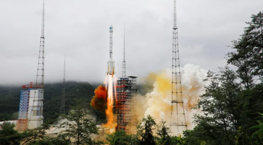
Zapis startu rakiety CZ-3B z Beidou-3GEO3 / Credits – CGTN
(...) Beidou-3GEO ma masę startową około 4600 kg. Satelita bazuje na chińskiej platformie DFH-3B. Wraz z tym startem budowa chińskiej konstelacji pozycjonowania satelitarnego (GNSS) o nazwie BeiDou została zakończona. Łącznie konstelacja składa się z 27 satelitów na średniej orbicie okołoziemskiej (MEO), 5 satelitów na orbicie GEO oraz 3 satelitów na pochylonej orbicie geosynchronicznej. Beidou-3GEO ma wejść do regularnej służby za około 2-3 miesiące.
Pierwsze satelity konstelacji BeiDou zostały umieszczone na orbicie w 2000 roku. Program chińskiego systemu pozycjonowania był budowany w fazach. Ostatnia, trzecia faza doprowadziła do globalnego zasięgu konstelacji BeiDou. (...)
https://kosmonauta.net/2020/06/konstelacja-beidou-gotowa/https://www.space24.pl/chinska-konstelacja-beidou-w-komplecie-nawigacja-o-globalnym-zasieguChina launches last BDS satelliteSource: Xinhua| 2020-06-23 09:43:54|Editor: huaxia
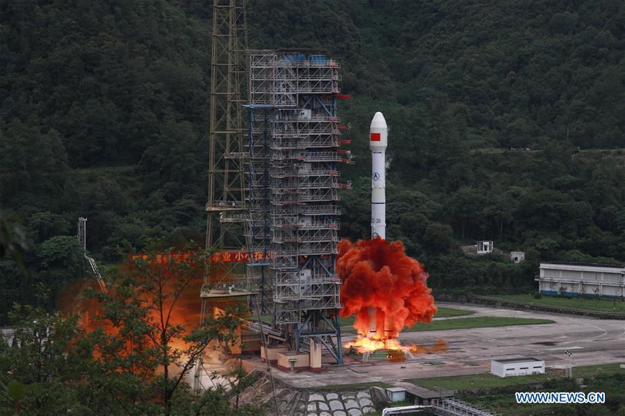
 A carrier rocket carrying the last satellite of the BeiDou Navigation Satellite System (BDS) blasts off from the Xichang Satellite Launch Center in southwest China's Sichuan Province, June 23, 2020. China launched the last BDS satellite from the Xichang Satellite Launch Center at 9:43 a.m. on Tuesday (Beijing Time). (Photo by Hu Xujie/Xinhua)
XICHANG, June 23 (Xinhua) -- China launched the last satellite of the BeiDou Navigation Satellite System (BDS) from the Xichang Satellite Launch Center in south
west China's Sichuan Province at 9:43 a.m. on Tuesday (Beijing Time).
The satellite, the 55th in the family of BeiDou that means "Big Dipper" in Chinese, was sent into space by a Long March-3B carrier rocket, according to the China Satellite Navigation Office. Enditem
http://www.xinhuanet.com/english/2020-06/23/c_139160060.htmChina launches last BDS satellite to complete global navigation constellationSource: Xinhua| 2020-06-23 15:47:14|Editor: huaxia
XICHANG, June 23 (Xinhua) -- China launched the last satellite of the BeiDou Navigation Satellite System (BDS) on Tuesday, marking the completion of the deployment of its own global navigation system.
The satellite, the 55th in the family of BeiDou that means "Big Dipper" in Chinese, was launched at 9:43 a.m. (Beijing Time) and sent into the preset orbit by a Long March-3B carrier rocket from the Xichang Satellite Launch Center in southwest China's Sichuan Province.
The mission, the 336th by the Long March rocket series, was a "complete success," the launch center said.
The satellite, designated to enter the geostationary earth orbit (GEO), was the last one of the BDS-3 system, which started to offer countries and regions along the Belt and Road as well as the world basic navigation service in December 2018.
BDS is one of four global navigation satellite systems in the world. The other three global navigation systems are GPS of the United States, Galileo of the European Union, and GLONASS of Russia.
China has been actively encouraging the cooperation and exchanges between the BDS system and other navigation systems in fields such as construction and application, strengthening compatibility and interoperability, resource sharing, and providing users with more qualified, diversified, safe and reliable services.
Compared with other global systems in the world, the design of the BDS constellation is unique, including medium earth orbit (MEO), inclined geosynchronous orbit (IGSO) and GEO satellites.
The BDS-3 system consists of a total of 30 satellites, including 24 MEO satellites, three IGSO satellites and three GEO satellites.
The three GEO satellites, including the newly launched one, can help significantly enhance the overall technical indicators of the BDS-3 system, according to the satellite developer China Academy of Space Technology (CAST).
They feature two distinctive creations of the BDS system -- active positioning and short message communication, CAST said.
The short message communication capability of the BDS-3 system has been improved 10 times. Users of the system can send a message of 1,200 Chinese characters at one time, as well as pictures, a useful function in emergencies.
Active positioning, employing radio measurement technology, can provide the locations of the users, not only to themselves, but also to relevant parties who are monitoring the users' whereabouts, through the joint efforts of two GEO satellites.
The function is widely used in search and rescue, fishing and other fields to help guarantee people's safety.
The BDS system provides navigation signals of multiple frequencies, and is able to improve service accuracy by using combined multi-frequency signals.
It also integrates navigation and communication capabilities for the first time, and can provide services of navigation, short message communication, satellite-based augmentation, international search and rescue, as well as precise point positioning.
"BDS provides time-and-space location benchmarks, which will have a great influence on the country's social and economic development, as well as people's lives," said Chen Zhonggui, chief designer of the BDS-3 satellites at CAST.
"It will also lay the foundation for new infrastructure construction, an important direction for China's development in the next stage," Chen said.
China started to explore a navigation satellite system suited to its national conditions in the 1980s, laying down a three-step strategy.
The BDS-1 project, the first step, also known as BeiDou Navigation Satellite Demonstration System, got official approval in 1994, when China was still facing an international technology blockade and domestic component manufacturers were not yet fully fledged.
The team started the exploration work with the solar arrays, recalled Fan Benyao, chief designer of BDS-1 at CAST.
Insisting on self-reliance, the older generation of the BDS team overcame a series of technical problems, including those relating to the Dongfanghong-3 satellite platform and key components that might affect the service life of the satellites.
BDS-1 was completed and put into operation in 2000 with the launching of two satellites, providing useful experience in the areas of construction and application, as well as training professionals for the following projects.
The second step was to construct the BDS-2 system, which started in 2004.
The team worked around the clock, at one point conducting 200-hour non-stop power-on tests at the launch site.
By the end of 2012, a total of 14 satellites, including five GEO satellites, five IGSO satellites and four MEO satellites, were successfully launched to complete the deployment.
The BDS-2 system is the world's first hybrid constellation, in which satellites in three kinds of orbits work in concert. It started providing regional services for users in the Asia-Pacific region in December 2012. Enditem
http://www.xinhuanet.com/english/2020-06/23/c_139161026.htmCommentary: China's BeiDou system primed for serving whole worldSource: Xinhua| 2020-06-23 17:19:17|Editor: huaxia by Xinhua writer Gao Wencheng
BEIJING, June 23 (Xinhua) -- China launched the last satellite of the BeiDou Navigation Satellite System (BDS) on Tuesday, marking the completion of the country's independently developed orbital navigation network, and a landmark step of its peaceful exploration of space.
The BeiDou network, a major infrastructure independently constructed and operated by China, can better meet the demands of the country's national security, economic as well as social development. It can also provide more stable and reliable services, as well as an alternative to the U.S.-owned Global Positioning System (GPS) for global users.
Given national security concerns due to the GPS's dominance, China is not the only one in the world that strives to develop its satellite navigation systems. For many years, the European Union, Russia and others have all been working on their own projects.
Thus one of the BDS's prominent principles is indigenous innovation. Core technologies as well as key components and software of the BDS are independently developed and manufactured by China.
Such an independent drive in the field of scientific and technological research and development echoes the very spirit pursued by many Chinese scientists who once dedicated themselves to the "Two Bombs, One Satellite" project during the Cold War era when China was under nuclear threats by some major world powers.
In recent years, Washington has been stepping up its high-tech blockade against China. America's descending technological iron curtain has further underscored the importance of indigenous technological advancement in key areas, which is imperative to China's national security and development.
The BeiDou system also features openness and compatibility. The system provides open satellite navigation services free of charge, encourages international exchanges and cooperation, and strives to enhance compatibility and interoperability with other navigation satellite systems, so as to provide better services to users worldwide.
After 26 years of arduous work, the BDS has now earned a global reputation for its high-accuracy service and various service capabilities in positioning, navigation and timing, short message communication, and international search and rescue.
In a congratulatory video message, the United Nations Office for Outer Space Affairs Director Simonetta Di Pippo said: "The services provided by BeiDou are already driving social and economic development around the world."
Indeed, the BDS-based solutions have already been successfully adopted in such fields as land registration, precise agriculture, digital construction, monitoring and management on vehicles and ships, intelligent port management in regions like Asia, East Europe, and Africa.
Also, the BDS-enabled products have been exported to more than 100 countries, providing users with a variety of choices and enhanced application experience.
Thousands of years ago, the Chinese invented the compass, which had made long-range voyages on rough and vast seas possible, and helped usher in the Age of Discovery.
Today, the BDS network is primed for facilitating an even stronger global connectivity in this age of globalization, and helping countries worldwide to chart their own courses into a better future. Enditem
http://www.xinhuanet.com/english/2020-06/23/c_139161296.htmChina launches final satellite to complete Beidou system, booster falls downrangeby Andrew Jones — June 23, 2020
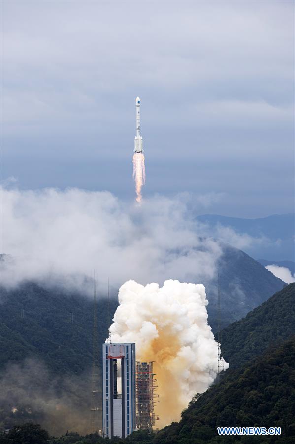
 A Long March 3B lifts off from LC-2 at Xichang carrying the final Beidou satellite, June 22, 2020. Credit: CASC
HELSINKI — China launched a Beidou-3 navigation satellite late Monday to complete a project designed to provide military independence and immense commercial value. (...)
“But with four GNSS soon to be live, I am sceptical over how much leverage China will get in civil/commercial terms with other parts of the world given that other states and companies can go shopping for other infrastructure if China decides to not allow them to use it as they wish,” Bowen says.
Bowen states that the primary benefit of the system is for modernizing China’s military forces and integrating spacepower into its terrestrial strike forces and long-range conventional missile systems.
“However, to truly capitalise on this the People’s Liberation Army needs to distribute a lot of receivers which will take time, and of course its modernizing forces need to get used to conducting high-intensity space-enabled military operations. America and its allies have 30 years of experience in this and have developed a lot of skills and institutional memory on how to use GPS in combat. China can’t claim to have that – not yet anyway.” (...)
https://spacenews.com/china-launches-final-satellite-to-complete-beidou-system-booster-falls-downrange/China launches final Beidou navigation satelliteJune 23, 2020 Stephen Clark
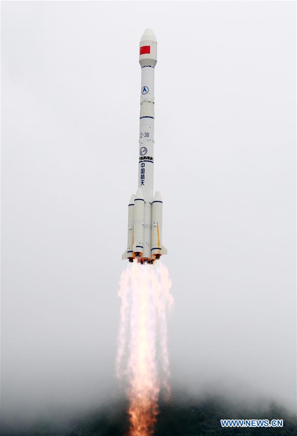
 A Long March 3B rocket launches from the Xichang space center in southwestern China at 0143 GMT Tuesday (9:43 p.m. EDT Monday). Credit: Xinhua
(...) The Long March 3B rocket launch puts China on the verge of completing the deployment of the Beidou program’s third-generation, or BDS-3, satellite network. It was be the 35th BDS-3 satellite launched since 2015 — including test and validation satellites — and the 59th Beidou spacecraft launched since 2000.
China has reportedly spent approximately $10 billion on the Beidou program, which the Chinese government approved for development in 1994.
The Beidou network, named for the Chinese word for the Big Dipper constellation, includes satellites positioned in three different types of orbits. The Beidou system needs at least 30 satellites operating at any one time for uninterrupted global navigation service.
In December, China launched the last of 24 operational satellites into a medium-altitude orbit more than 13,000 miles (21,000 kilometers) above Earth, similar to the orbits used by GPS, Glonass and Galileo satellites.
But unlike the other global navigation systems, the fully-operational Beidou network includes six spacecraft in geosynchronous orbits more than 22,000 miles (nearly 36,000 kilometers) above Earth, with three permanently over the equator and three others in inclined orbits that swing north and south of the equator during each 24-hour orbit.
China launched three satellites into inclined geosynchronous orbits last year, and the final Beidou spacecraft launched Tuesday is the third of three to be permanently stationed over the equator.
The satellite delivered to orbit Tuesday will use its on-board propulsion to circularize its orbit more than 22,000 miles over the equator in the coming weeks before ground controllers put the spacecraft through testing. It is expected to enter service in a few months.
The first four Beidou satellites broadcast positioning and timing signals over China. The second phase of the Beidou system, known as BDS-2, was completed in 2012 to provide navigation services over the broader Asia-Pacific region.
As of this week, China’s Beidou network had 44 operational spacecraft, including BDS-2 and BDS-3 satellites. (...)
https://spaceflightnow.com/2020/06/23/china-launches-final-beidou-navigation-satellite/https://www.nasaspaceflight.com/2020/06/china-complete-beidou-constellation-long-march-3b/BD-3 G
https://space.skyrocket.de/doc_sdat/bd-3g.htm
 Wątek: Starty rakiet (II kwartał 2020 roku) (Przeczytany 20786 razy)